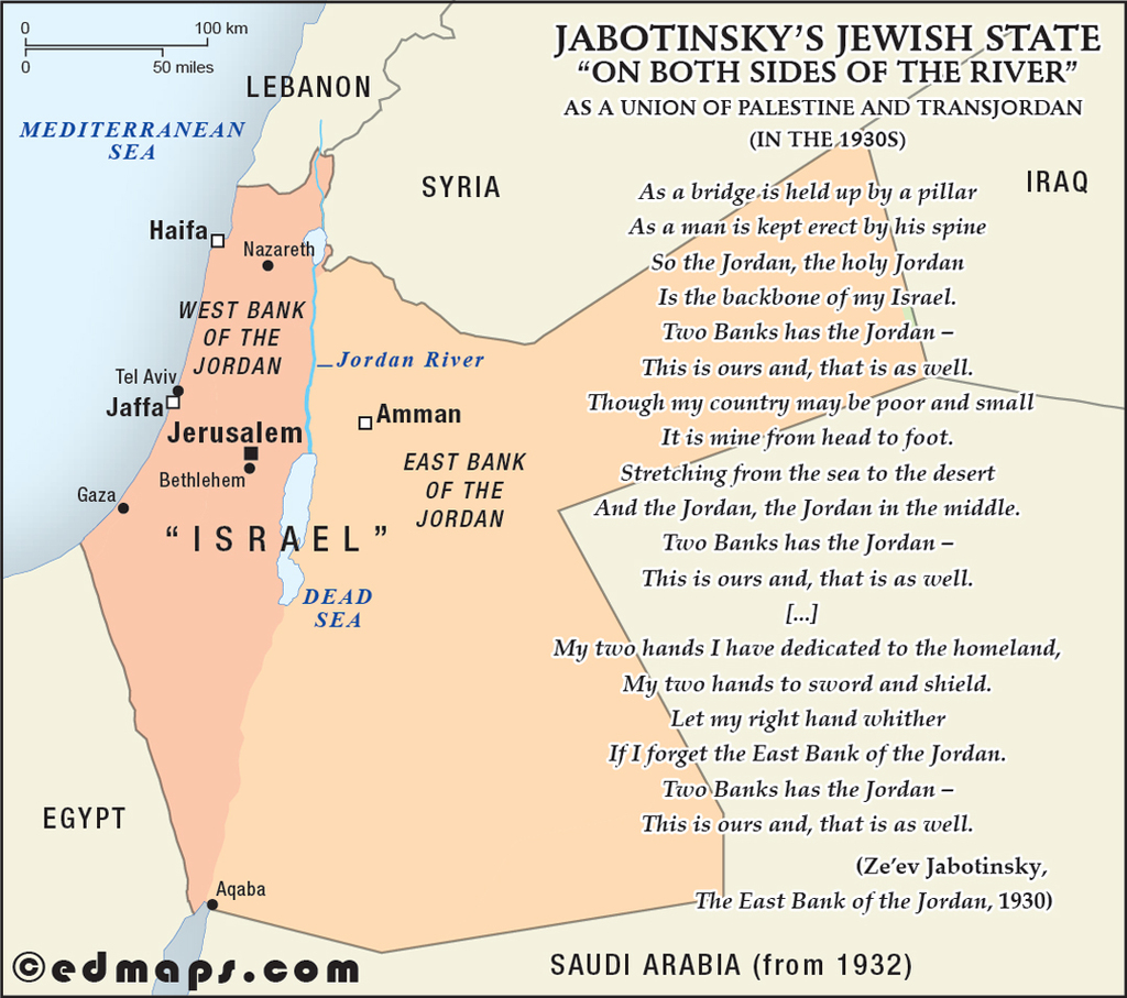
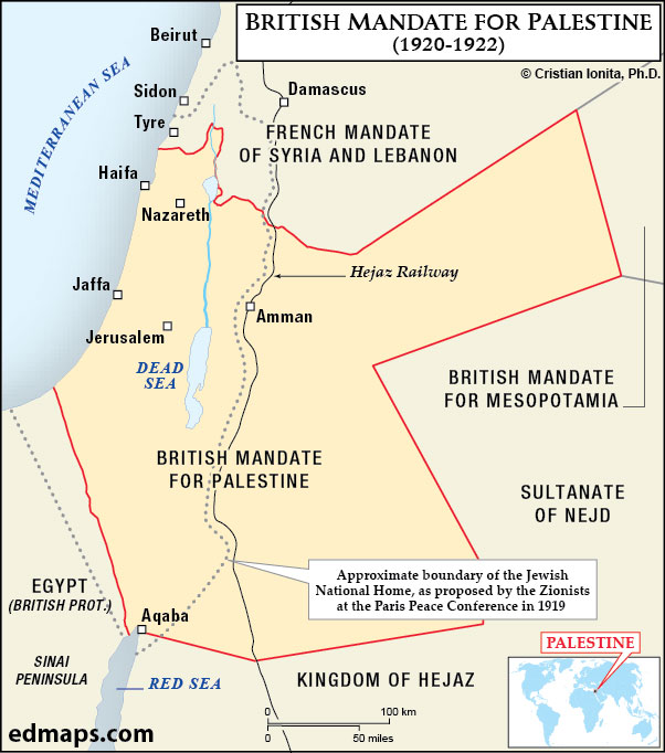
This section presents a collection of original historical maps of Israel and Palestine, illustrating the evolution of the region, with its political structures, territories, and borders, from early periods to the present day. These maps highlight how historical events and trends, political reforms, territorial reorganizations, and regional identities have shaped the history and historical geography of these lands over time. Designed for educational use, the collection provides clear and accessible visual resources suitable for classroom teaching, school projects, and introductory historical study.
The conflict appears intractable because it is a contest over the same land by two peoples who always believed they had valid title to it and who hoped that the other side would in time give up or go away. One side won the war, the other lost, but the contest is as alive as ever.
Edward Said (1999)
See also more original maps :
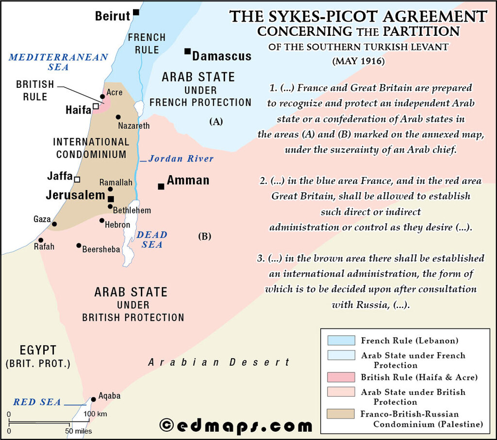
This agreement divided Ottoman Middle East territories between Britain and France, creating spheres of influence in modern-day Syria, Iraq, Lebanon, and Palestine.
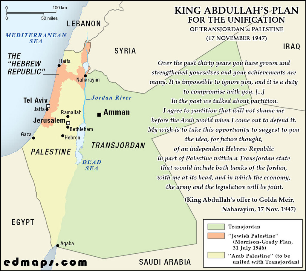
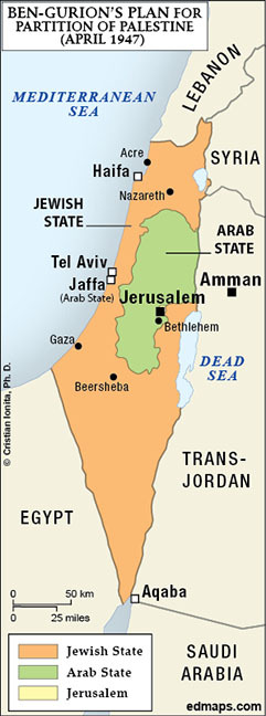
In 1947, King Abdullah I proposed annexing Arab Palestine to Transjordan, offering Jewish autonomy within an enlarged kingdom, rejected by Zionists seeking an independent state.
See also :
Palestine in Ten Maps — original historical maps of the territorial evolution of the Palestinian Question;
Israel and Palestine on the Map — original historical maps of the territorial evolution of Israel and Palestine;
Palestine: History, Borders, Maps — original & curated historical maps of Israel and Palestine;
Historical Maps of Israel & Palestine — curated links to historical maps and resources covering Israeli and Palestinian history;
Historical Geography of Palestine — maps from G. A. Smith, Atlas of the Historical Geography of the Holy Land (1915).
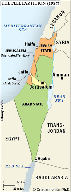
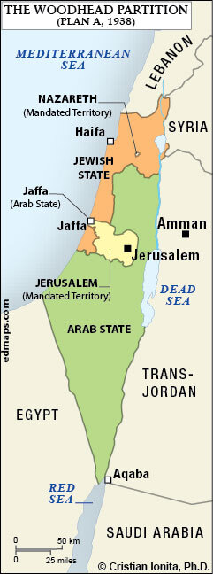
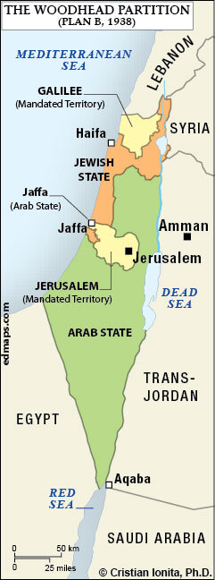
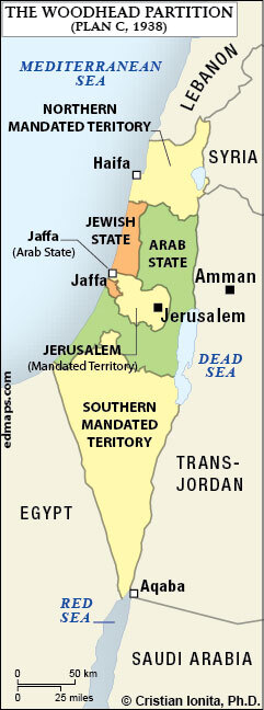
Sources, Methodology & Educational Use: The maps presented on this page are original creations produced for edmaps.com by Dr. Cristian Ionita. Each map is based on verified historical data relating to the territorial evolution of the historical Palestine and the new political entities of Israel and Arab Palestine, including changes in borders, administrative structures, and regional historical developments. The maps are designed according to established practices in historical cartography, including source analysis, period contextualization, and visual clarity. The collection is curated to support teaching, learning, and public understanding of the region’s historical geography, and is intended for educational and non‑commercial use.
edmaps.com — Historical Cartography for Education
edmaps.com provides original maps and curated historical maps designed to support teaching, learning, and public understanding of history and historical geography. The original maps are created by Dr. Cristian Ionita, and all curated maps are selected from public archives, historical collections, and private holdings, and are presented for educational and non‑commercial use.
© Cristian Ionita. All rights reserved.
Website: https://edmaps.com — Contact: info@edmaps.com